

RCFlyMaps app for iPhone and iPad
Developer: Helixline LLC
First release : 03 Oct 2014
App size: 4.04 Mb
What is RCFlyMaps?
RCFlyMaps is simply a way to see where to fly and where not to fly RC, based on info that I was able to obtain from the FAA and other resources. We place this data into an always connected database in the cloud. This is pretty important. Why? It means our application has access to the very latest local data without requiring our users to update an application via the App Stores and loading large databases on the mobile device. You may be asking why is that necessary since these airports and national park data are not going to change very often. Well, if that is all RCFlyMaps did, I would agree with you. But, this app is more.
`
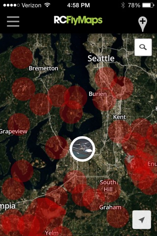
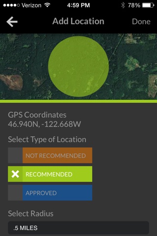
With this cloud connected data store we are able to allow users to input their own recommended and not recommended places to fly. This is huge! Real time data, wherever you may be. You will see every airport and the 3 mile radius around it, you will see as many AMA authorized fields as I could find, and you will see crowdsourced data on the best/worst places to fly. You will have a list of all the places you like to fly, and you will be able to “favorite” any location for future reference.
You must enable location services to use app. Go to Privacy > Location Services > RCFlyMaps and select "Always"